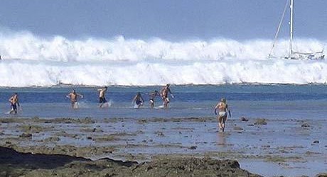
A thick plateau of strong rock along the seabed may have allowed the massive, magnitude 9.1 Sumatra earthquake to reach far closer to the Earth’s surface, giving the deadly tsunami it triggered even greater power, according to new research.
The earthquake occurred along a subduction zone, an area where one massive tectonic plate is diving beneath another. As one rocky plate is forced beneath another, sediments are scraped off in the process and accumulate along the subduction zone.
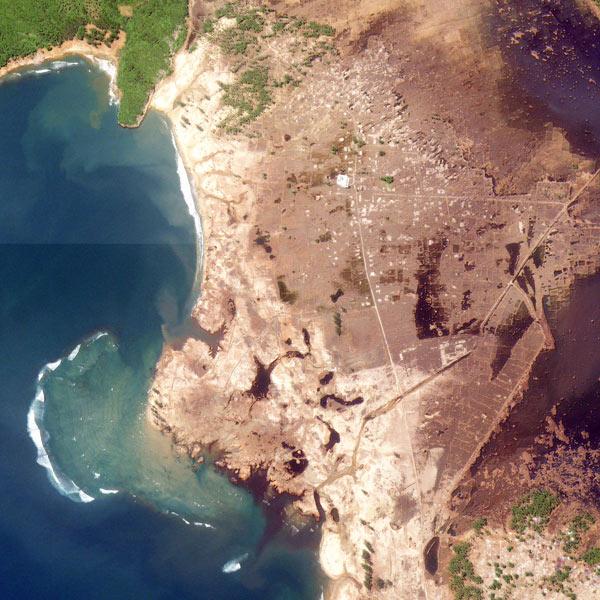
Indonesia, December 29, 2004 — three days after a massive tsunami swept across the once-lush coastline. Credit: USGS, IKONOS
In some cases those sediments are comparatively weak, and form slopes along the trenches on the seafloor where the plates meet. Yet along the Sumatra quake subduction zone, researchers discovered a flat sediment plain about 2.5 to 3 miles (4 to 5 kilometers) thick and 80 miles (130 km) wide, PlanetEarth Online reported.
Weaker sediments — those with a consistency closer to taffy — tend so slow the energy of an earthquakeas it races from deep inside the earth toward the seabed. Yet if the sediments are strong — more akin to peanut brittle — the earthquake can displace larger portions of the seafloor, according to the PlanetEarth Online report.
It appears the plain near Sumatra is made of particularly strong sediments that allowed the quake’s rupture to move quickly, thus reaching closer to the seafloor and displacing even more water than it might have otherwise, thus producing a particularly large tsunami.
The research is published online in the June 19 issue of the journal Nature Geoscience.
Updip rupture of the 2004 Sumatra earthquake extended by thick indurated sediments
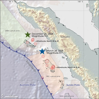
The earthquake struck just north of the Indonesian island of Simeulue west of Sumatra. It was caused by a massive movement of the Indo-Australian plate which is being pushed beneath the Sunda plate to the east. This is known as a subduction zone and in this case the plates meet at the Sunda Trench, around 300km west of Sumatra.
The Sunda Trench is full of ancient sediment, some of which has washed out of the Ganges over millions of years forming a massive accumulation of sedimentary rock called the Nicobar Fan. As the Indo-Australian plate is subducted, these sediments are scraped off to form what’s called an accretionary prism. Usually an accretionary prism slopes consistently away from the trench, but here the seabed shallows steeply before flattening out, forming a plateau.
Subduction earthquakes are thought to start around 30km beneath the Earth’s surface. Slip on the fault propagates upwards and generally dissipates as it reaches weaker rocks closer to the surface. So the sediment in the Sunda Trench should have slowed the upward and westward journey of the 2004 earthquake, meaning the tsunami was generated in the shallower water on the landward (east) side of the trench.
But in fact the fault slip seems to have reached close to the trench, lifting large sections of the seabed in deeper water and producing a much larger tsunami.
To understand what might be behind this uncharacteristic geological behaviour, the research team looked at seismic images of the earth’s crust around part of the 2004 rupture zone.
They found that the sediments in the trench are 4-5km thick, and where they form a plateau in the accretionary prism the sediments allow seismic waves to travel much faster than you find at locations immediately to the south. This indicates that the rocks are stronger than would be expected.
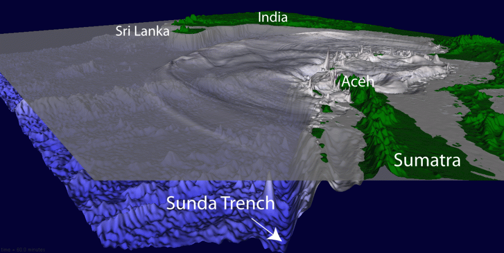
Click here for animation (2.3 MB)
The researchers found no evidence for any ‘splay faults’ in the accretionary prism which would have helped dissipate the earthquake’s power. So the depth and solidity of these overlying sediments seems to have played a part in the power of the devastating tsunami that the earthquake generated.
Assessments of earthquake hazard around the world should look closely at similar subduction zones, says the researchers’ report. A plateau formed of strong sediments overlying an area of converging plates could represent a greater hazard for tsunami generation than previously known. (PlanetEarth)






No comments