Rare November hurricane Kenneth formed south of Mexico
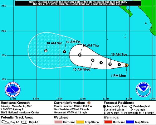
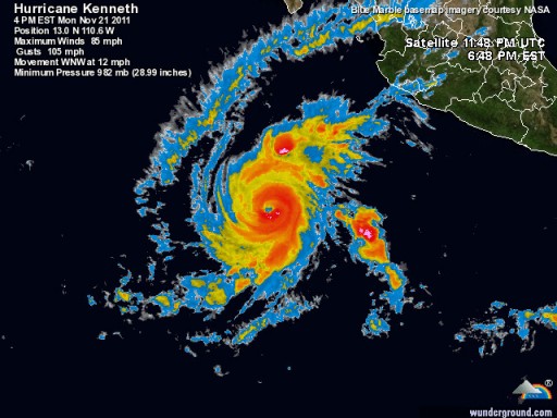
Hurricane Kenneth has formed in the eastern Pacific Ocean, a rare feat for this time of year. Officialy the hurricane season ends on November 30. Tropical Depression 13-E took shape Saturday afternoon and strengthened into Tropical Storm Kenneth about 24 hours later. During Monday morning, Kenneth became a hurricane. It is possible that Kenneth reaches category 3 status, a major hurricane, the next few days prior to eventual weakening over colder waters later in the week.
According to the National Hurricane Center, on 20 November 2011 Tropical Storm Kennethbecame the latest-forming named tropical storm in the eastern North Pacific basin since Hurricane Winnie formed on 04 December 1983.
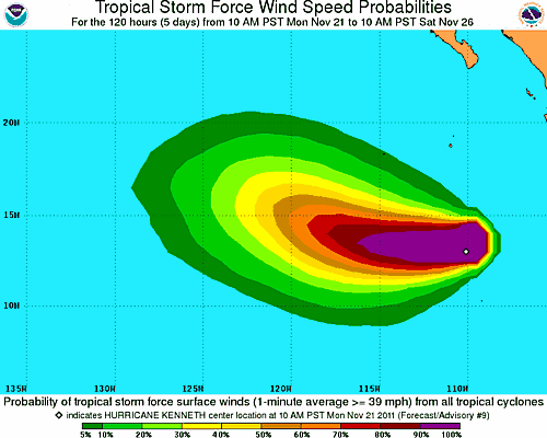
No land masses lie in the projected westward path of Kenneth. However, shipping lanes will be threatened. As Kenneth continues to intensify, residents and vacationers along Mexico’s southwestern coast may notice an increase in wave action.
| …KENNETH CONTINUES TO STRENGTHEN… | |||||||
| 1:00 PM PST Mon Nov 21 Location: 13.0°N 110.6°W Max sustained: 85 mph Moving: WNW at 13 mph Min pressure: 982 mb | Public Advisory #9 100 PM PST | Forecast/ Advisory #9 2100 UTC | Forecast Discussion #9 100 PM PST | Wind Speed Probabilities #9 2100 UTC | |||
Satellite Imagery
- Storm Region Infrared (GOES 13; FNMOC)
- Storm Region Enhanced Infrared (GOES 13; FNMOC)
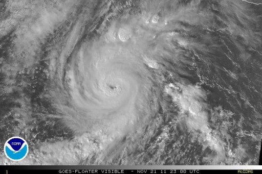
- Storm Region Visible (GOES 13; FNMOC)
- Storm-Centered Infrared (GOES 11; NOAA/SSD)
- Storm-Centered Infrared (Aviation Color Enhancement) (GOES 11; NOAA/SSD)
- Storm-Centered Water Vapor (GOES 11; NOAA/SSD)
- Storm-Centered Visible (GOES 11; NOAA/SSD)
- Storm-Centered Water Visible (Colorized) (GOES 11; NOAA/SSD)
- Tropical East Pacific Hurricane Sector Infrared (GOES 11; NOAA)
- Tropical East Pacific Hurricane Sector Water Vapor (GOES 11; NOAA)
- Tropical East Pacific Hurricane Sector Visible (GOES 11; NOAA)



No comments