
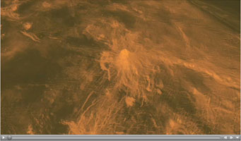
The hemispheric view of Venus, as revealed by more than a decade of radar investigations culminating in the 1990-1994 Magellan mission, is centered on the North Pole. The Magellan spacecraft imaged more than 98% of Venus at a resolution of about 100 meters; the effective resolution of this image is about 3 km. A mosaic of the Magellan images (most with illumination from the west) forms the image base. Gaps in the Magellan coverage were filled with images from the Earth-based Arecibo radar in a region centered roughly on 0 degree latitude and longitude, and with a neutral tone elsewhere (primarily near the south pole). The composite image was processed to improve contrast and to emphasize small features, and was color-coded to represent elevation. Gaps in the elevation data from the Magellan radar altimeter were filled with altimetry from the Venera spacecraft and the U.S. Pioneer Venus missions. An orthographic projection was used, simulating a distant view of one hemisphere of the planet. The Magellan mission was managed for NASA by Jet Propulsion Laboratory (JPL), Pasadena, CA.
Data processed by JPL, the Massachusetts Institute of Technology, Cambridge, MA, and the U.S. Geological Survey, Flagstaff, AZ.
Southwest Lakshmi Planum (plains) is bounded on the south by the Danu Montes (mountains). Lakshmi Planum is an elevated plateau plain that is bounded on all sides by mountain chains. Here, the Danu mountains have an angular fractured appearance. Chasms slice diagonally across the mountains in the lower left (southwest) corner of the image. Because of the steep slopes and the local relief of the mountains of several kilometers (2-3 miles, these fault-bounded troughs appear to zig-zag through the mountains when, in fact, they are probably straight if viewed from above. The radar view provides a perspective that would place the viewer's eye to the right, 27 degrees above the horizon.
Thus, slopes facing to the right can be seen completely, though dark, and slopes facing away to the left appear shortened, often seen only as thin bright lines. In the center of the image is a low volcanic dome (20 kilometers (12 miles) in diameter. This type of volcanic feature frequently occurs on the low plains. This dome on the edge of Lakshmi is deformed and faulted where it has been affected by the forces that created the Danu mountains. The image is 75 kilometers (46 miles) on a side. The center is at 60 degrees north latitude, 324.5 degrees east longitude.
This false color Magellan image shows a portion of Bereghinya Planitia (plains) in the northern hemisphere of Venus, centered at 31 degrees north latitude, 43 degrees east longitude. The area is 260 kilometers (160 miles) wide and 330 kilometers (200 miles) long. This image was produced from Magellan radar data collected in Cycle 2 of the mission. Cycle 2 was completed January 15, 1992. The area was not imaged during the first cycle because of superior conjunction when the sun was between the Earth and Venus, preventing communication with the spacecraft. This image contains examples of several of the major geologic terrains on Venus and illustrates the basic stratigraphy or sequence of geologic events. The oldest terrains appear as bright, highly-fractured or chaotic highlands rising out of the plains. This is seen in the upper right and lower left quadrants of the image.
The chaotic highlands, sometimes called tessera, may represent older and thicker crustal material and occupy about 15 percent of the surface of Venus. Plains surround and embay the fractured highland tessera. Plains are formed by fluid volcanic flows that may have once formed vast lava seas which covered all the low lying surfaces. Plains comprise more than 80 percent of the surface of Venus. The most recent activity in the region is volcanism that produced the radar bright flows best seen in the lower right quadrant of the image. The lava flows in this image are associated with the shield volcano Tepev Mons whose summit is near the lower left corner of the image. The flows are similar to the darker plains volcanics, but apparently have more rugged surfaces that more efficiently scatter the radar signal back to the spacecraft. The geologic sequence is early fracturing of the tessera, flooding by extensive plains lavas and scattered, less extensive individual flows on the plains surface. The simulated hues are based on color images recorded by the Soviet Venera 13 and 14 spacecraft.
This Magellan image from the Atla region of Venus shows several types of volcanic features and superimposed surface fractures. The area in the image is approximately 350 kilometers (217 miles) across, centered at 9 degrees south latitude, 199 degrees east longitude. Lava flows emanating from circular pits or linear fissures form flower-shaped patterns in several areas. A collapse depression approximately 20 kilometers by 10 kilometers (12 by 6 miles) near the center of the image is drained by a lava channel approximately 40 kilometers (25 miles) long. Numerous surface fractures and graben (linear valleys) criss-cross the volcanic deposits in north to northeast trends. The fractures are not buried by the lavas, indicating that the tectonic activity post-dates most of the volcanic activity.
This Magellan full resolution radar image is centered at 65 degrees north latitude, zero degrees east longitude, along the eastern edge of Lakshmi Planum and the western edge of Maxwell Montes. The plains of Lakshmi are made up of radar-dark, homogeneous, smooth lava flows. Located near the center of the image is a feature previously mapped as tessera made up of intersecting 1- to 2-km (0.6 to 1.2 miles) wide graven. The abrupt termination of dark plains against this feature indicates that it has been partially covered by lava. Additional blocks of tessera are located along the left hand edge of the image. A series of linear parallel troughs are located along the southern edge of the image. These features, 60- to 120-km (36- to 72- miles) long and 10- to 40- km (6- to 24- miles) wide are interpreted as graben.
Located along the right hand part of the image is Maxwell Montes, the highest mountain on the planet, rising to an elevation of 11.5 km (7 miles) and is part of a series of mountain belts surrounding Lakshmi Planum. The western edge of Maxwell shown in this image rises sharply, 5.0 km (3.0 miles), above the adjacent plains in Lakshmi Planum. Maxwell is made up of parallel ridges 2- to 7-km (1.2- to 4.2 miles) apart and is interpreted to have formed by compressional tectonics. The image is 300 km (180 miles) wide.
The Magellan synthetic aperture radar (SAR) imaged this unique 'triplet crater,' or 'crater field' during orbits 418-421 on 21 September 1990. These craters are 14 kilometers, 11 kilometers, and 9 kilometers in diameter, respectively, and are centered at latitude -30.1 degrees south and longitude 345.5 degrees east. The Magellan Science Team has proposed the name Stein for this crater field after the American author, Gertrude Stein. This name has not yet been approved by the International Astronomical Union. The crater field was formed on highly fractured plains. The impacts generated a considerable amount of low viscosity 'flows' thought to consist largely of shock-melted target material along with fragmented debris from the crater. The three craters appear to have relatively steep walls based on the distortion in the image of the near and far walls of the craters in the Magellan radar look direction (from the left). The flow deposits from the three craters extend dominantly to the northeast (upper right).


No comments